From retreating glaciers to the appearance of man-made islands off the coast of Dubai: The incredible animations that reveal how much our planet has changed in just 28 YEARS
- Images created using Landsat satellite images and Google map data
- Show everything from the spread of Las Vegas to Brazilian Amazon Deforestation
By Mark Prigg
PUBLISHED: 13:16 GMT, 10 May 2013 | UPDATED: 16:33 GMT, 10 May 2013
They are a breathtaking visualisation of just how quickly our planet is changing.
Google has released these astonishing images showing data collected from the Landsat satellite from 1982 until 2012.
They reveal everything from man's impact on the desert as Las Vegas expands to the retreat of glaciers in Columbia.
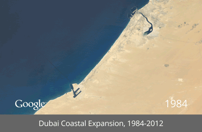 The Coastal Expansion of Dubai, revealing two palm trees and a
map of the world appear as islands off the coast as vast swathes
of construction are undertaken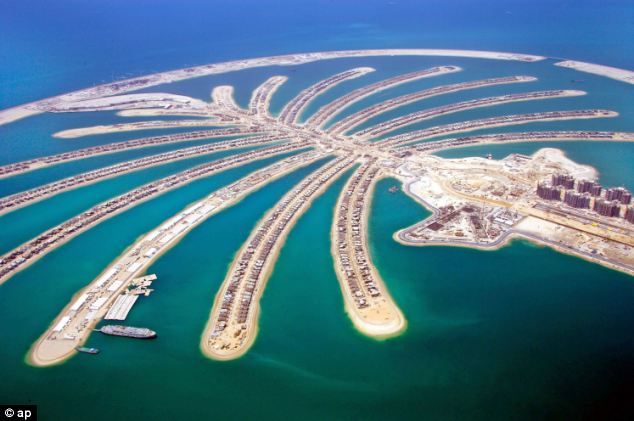 Jumeira Palm Island in Dubai from nearer the ground: 14,000 laborers toiled day and night on the developmentHOW THEY DID IT
Each frame of the timelapse map is constructed from a year of Landsat satellite data, constituting an annual 1.7-terapixel snapshot of the Earth at 30-meter resolution.
The Landsat program, managed by the USGS, has been acquiring images of the Earth's surface since 1972. Landsat provides critical scientific information about our changing planet.
Google worked with the U.S. Geological Survey (USGS), Nasa and Time to develop the images, even digitising tapes containing the early data from the satellites.
...more at link (more animations)http://www.dailymail.co.uk/sciencetech/ ... YEARS.html


 Do not go gentle into that good night.